A Leaflet Map with Another Dimension
Projects: 2026-11
What if a Leaflet map had a little more depth? My leaflet-city-mapper repository, created in November 2026, is a small WebGPU rendering engine for bringing 3D content into Leaflet layers.
The current project documentation describes extruded GeoJSON, glTF models, raster and vector sources, and terrain. Its examples visit Paris, ancient Rome and the Matterhorn. A familiar map, with a different perspective.
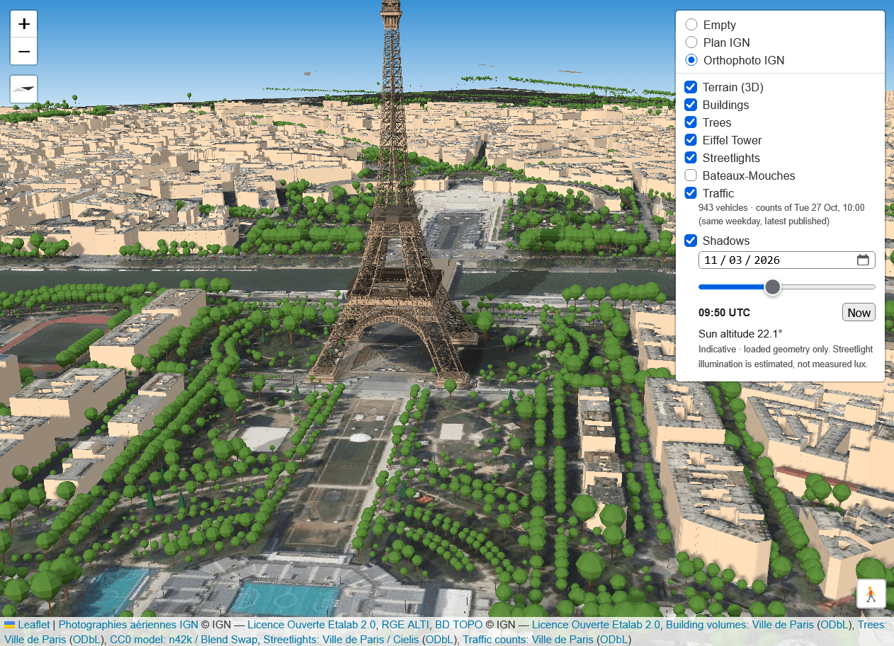
A current illustration of leaflet-city-mapper.