leaflet-ui


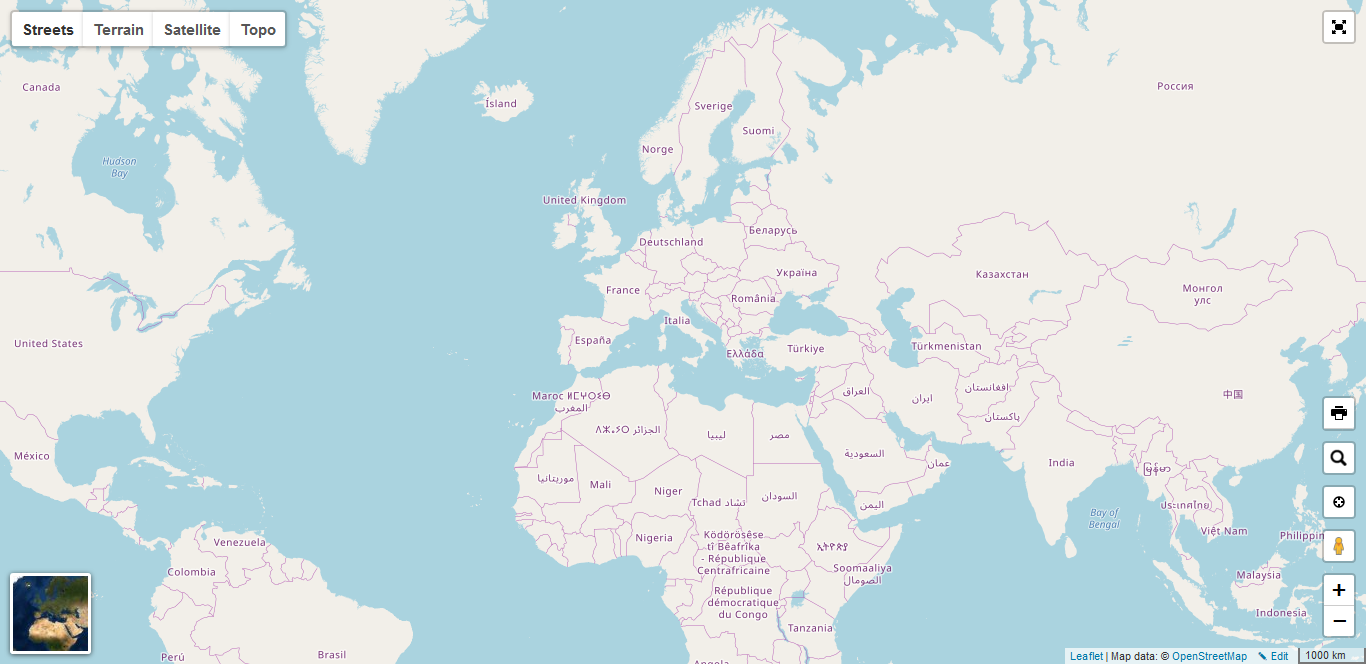
Leaflet presets for a ready-to-use map: base layers, map controls, and sensible defaults in one package.
For a working example see demo
How to use
Just load leaflet first, then leaflet-ui.
<link rel="stylesheet" href="https://unpkg.com/leaflet@1.9.4/dist/leaflet.css">
<script src="https://unpkg.com/leaflet@1.9.4/dist/leaflet.js"></script>
<script src="https://unpkg.com/leaflet-ui@0.8.1/dist/leaflet-ui.js"></script>

<style>
  html, body, #map { height: 100%; margin: 0; }
</style>

<div id="map"></div>
<script>
  const map = L.map('map', {
    center: [41.4583, 12.7059],
    zoom: 5,
    mapTypeId: 'topo',
    mapTypeIds: ['streets', 'terrain', 'satellite', 'topo'],
  });
</script>
By default, Leaflet UI adds its controls and base layers. Choose the active layer with mapTypeId; limit the layer switcher with mapTypeIds.
Options
Pass options to L.map alongside Leaflet’s regular map options. For each control, false disables it, true uses the preset below, and an object overrides or extends that control’s preset. Control-specific options are passed to the corresponding Leaflet plugin.
const map = L.map('map', {
  center: [41.4583, 12.7059],
  zoom: 5,
  mapTypeId: 'topo',
  searchControl: false,
  fullscreenControl: { position: 'topleft' },
  printControl: true,
});
Map and package options
| Option | Default | Description |
|---|---|---|
mapTypeId |
'streets' |
ID of the initially selected base layer. |
mapTypeIds |
['streets', 'terrain', 'satellite', 'topo'] |
IDs of base layers to create and show in the layer control. |
mapTypes |
See built-in base layers | Base-layer definitions. Add or override entries by ID. |
gestureHandling |
true |
Enable the gesture-handling plugin. |
visualClick |
true |
Enable the visual-click plugin. |
rotate |
false | Enables map rotation and pitch. |
zoomControl |
true |
Show Leaflet’s zoom control. |
rotateControl |
position: 'bottomright' |
Configure the rotation control when Leaflet Rotate provides it. |
scaleControl |
true |
Show the scale control. |
pegmanControl |
true |
Show Pegman / Street View control. |
locateControl |
true |
Show the geolocation control. |
fullscreenControl |
true |
Show the fullscreen control. |
layersControl |
true |
Show the base-layer control. |
minimapControl |
true |
Show the minimap. |
editInOSMControl |
true |
Show the link to edit the current map area in OpenStreetMap. |
loadingControl |
true |
Show the loading indicator. |
searchControl |
true |
Show the location search control. |
printControl |
false |
Show the print/export control. |
resizerControl |
false |
Show the map resizer handle. |
disableDefaultUI |
false |
Do not initialize Leaflet UI’s default layers and controls. |
includeLeafletCSS |
true |
With plugins enabled, load Leaflet’s CSS if it is not already present. |
includeLeafletUICSS |
true |
With plugins enabled, load Leaflet UI’s CSS. |
plugins |
[] |
CSS or JavaScript URLs to load after map initialization. |
apiKeys |
undefined |
Provider keys; see API keys. |
Leaflet’s own options such as center, zoom, minZoom, maxZoom, layers, and attributionControl remain available. When disableDefaultUI is true, Leaflet UI does not create its default base layers or controls.
Built-in base layers
The mapTypes object has the following entries by default. mapTypeIds determines which of them are active and available in the layer control; atlas and cycle are defined but not enabled by default.
| ID | Name | Tile provider | Default tile options |
|---|---|---|---|
streets |
Streets | OpenStreetMap | maxZoom: 24, maxNativeZoom: 19, attribution required |
terrain |
Terrain | Thunderforest Landscape | maxZoom: 24, maxNativeZoom: 22, attribution required, retina r |
satellite |
Satellite | Esri World Imagery | maxZoom: 24, maxNativeZoom: 18, attribution required |
topo |
Topo | OpenTopoMap | maxZoom: 24, maxNativeZoom: 17, attribution required |
atlas |
Atlas | Thunderforest Mobile Atlas | maxZoom: 24, maxNativeZoom: 22, attribution required, retina r |
cycle |
Cycle | Thunderforest Cycle | maxZoom: 24, maxNativeZoom: 22, attribution required, retina r |
Each entry has name, url, and options. url is a Leaflet tile URL template; options accepts TileLayer options, including attribution. Replace a provider definition or add your own:
const map = L.map('map', {
  center: [41.4583, 12.7059],
  zoom: 5,
  mapTypes: {
    custom: {
      name: 'Custom',
      url: 'https://{s}.tile.example.com/{z}/{x}/{y}.png',
      options: { maxZoom: 20, attribution: '© Example' },
    },
  },
  mapTypeIds: ['custom'],
  mapTypeId: 'custom',
});
Control presets
These are the preset values merged into each control’s options object. Other options supported by a control’s underlying plugin can also be passed through.
| Option | Preset values |
|---|---|
zoomControl |
position: 'bottomright' |
rotateControl |
position: 'bottomright' |
scaleControl |
width: 200, position: 'bottomright', imperial: false |
pegmanControl |
position: 'bottomright', theme: 'leaflet-pegman-v3-small' |
locateControl |
position: 'bottomright' |
fullscreenControl |
position: 'topright', title: 'Enter Fullscreen', titleCancel: 'Exit Fullscreen', forceSeparateButton: true |
layersControl |
inline: true, position: 'topleft' |
minimapControl |
position: 'bottomleft', toggleDisplay: false, toggleMapTypes: true, width: 75, height: 75; see nested defaults below |
editInOSMControl |
position: 'bottomright' |
loadingControl |
separate: true, position: 'bottomright' |
searchControl |
See search defaults |
printControl |
position: 'bottomright', hideControlContainer: true, exportOnly: true, sizeModes: ['A4Portrait', 'A4Landscape'] |
resizerControl |
direction: 's' |
The minimap’s aimingRectOptions and shadowRectOptions both default to { color: '#000000', weight: 1, opacity: 0, fillOpacity: 0 }. Its nested mapOptions defaults to { mapTypeId: 'satellite', gestureHandling: false, searchControl: false, loadingControl: false, _isMiniMap: true, rotateControl: false }. These are Leaflet MiniMap options plus Leaflet UI map options.
Search control defaults
| Option | Default |
|---|---|
url |
https://nominatim.openstreetmap.org/search?format=json&accept-language={querylang}&q={s} |
querylang |
Browser language when detected; otherwise 'en-US' |
detectUserLang |
true |
jsonpParam |
'json_callback' |
propertyName |
'display_name' |
propertyLoc |
['lat', 'lon'] |
markerLocation |
true |
autoType |
false |
autoCollapse |
true |
firstTipSubmit |
true |
minLength |
1 |
zoom |
10 |
position |
'bottomright' |
API keys
apiKeys.thunderforest is applied to the built-in atlas, terrain, and cycle layers. apiKeys.google is applied to Pegman:
apiKeys: {
  thunderforest: 'YOUR_THUNDERFOREST_API_KEY',
  google: 'YOUR_GOOGLE_MAPS_API_KEY',
}
Custom plugins and events
Use plugins to load browser-ready plugin scripts or stylesheets when creating a map. This is useful for plugins that register Leaflet controls, layers, or map init hooks:
const map = L.map('map', {
  center: [41.4583, 12.7059],
  zoom: 5,
  plugins: [
    'leaflet-pointable@0.1.0/leaflet-pointable.js',
    '/assets/my-map-plugin.js',
    '/assets/my-map-plugin.css',
  ],
});

map.once('plugins_loaded', () => {
  // Plugin scripts are ready; use their APIs here.
});
Each entry is loaded as a stylesheet if its URL ends in .css, otherwise as a script. Supported URL forms:
| URL form | Example | Resolved from |
|---|---|---|
| Package path | leaflet-pointable@0.1.0/leaflet-pointable.js |
https://unpkg.com/ |
| Root-relative path | /assets/my-plugin.js |
Current site’s origin |
| Relative path | ./assets/my-plugin.css |
Current document URL |
| Absolute URL | https://cdn.example.com/my-plugin.js |
As provided |
Leaflet UI loads Leaflet CSS when includeLeafletCSS is enabled and it is not already detected, and loads Leaflet UI CSS when includeLeafletUICSS is enabled. It then loads custom plugin URLs. URLs within each group are requested in parallel, so do not rely on the order of entries in plugins for script dependencies. If one plugin depends on another, bundle them together or load them yourself in dependency order before creating the map.
The default plugins: [] still enables this loading step, including Leaflet UI CSS. Set includeLeafletCSS: false or includeLeafletUICSS: false to skip the corresponding stylesheet. Set plugins: false to skip the plugin-loading step entirely, including its automatic stylesheet loading.
Events
These are the events Leaflet UI itself fires on the map:
| Event | When it fires | Conditions |
|---|---|---|
idle |
The map is ready and its initial layers have been added. | Fires when default UI initialization runs; not fired with disableDefaultUI: true. |
plugins_loaded |
Leaflet UI’s automatic stylesheet and plugins loading step completes. |
Fires when plugins is truthy (including the default empty array); not fired with plugins: false. |
initHooks_called |
After plugins_loaded, once newly registered Leaflet map init hooks have been called for this map. |
Fires when plugins is truthy. |
Listen for these events on the map:
const map = L.map('map', { plugins: ['/assets/my-plugin.js'] });

map.once('idle', () => console.log('Map ready'));
map.once('plugins_loaded', () => console.log('Plugin files loaded'));
map.once('initHooks_called', () => console.log('Plugin map hooks called'));
Attach listeners immediately after constructing the map. plugins_loaded and initHooks_called are asynchronous because they wait for resource loading; idle is tied to Leaflet’s map-ready lifecycle. Leaflet’s standard map events and events emitted by bundled or custom plugins are also available, but are not generated by Leaflet UI itself; see the relevant plugin documentation for their names and payloads.
Use tile providers according to their terms of service and include their required attribution.
Development
npm install
npm run dev
npm test
npm test builds the bundle and runs browser tests.
Compatible with:


Contributors: Raruto